
Stay off the States
Wayfinding in Washington DC
October 31, 2018
Washington DC, is one of my favorite cities anywhere. And great for walking—you can get to most of the cool and interesting parts of town on foot. Add in the terrific Metro and nothing is off limits to the non-driver. However, unless you live there, do not try to find your way by using streets with names of US states. Avoid Massachusetts, New York, and especially, New Hampshire. Stay off New Jersey, Vermont and don’t even think about Florida. I always tell people heading to DC, stay on streets with numbers and letters. 1, 2, 3; A, B, C.
Why? Because in 1791 when designing the new ‘federal city’ at the request of George Washington, French planner Pierre L’Enfant created a perfectly logical rectangular urban grid and then did the unthinkable: he overlaid his rational grid with a Paris-like pattern of monumental traffic circles connected by wagon-wheel type boulevards, all at crazy angles and each was later named for a US state. The circle and spokes format has nothing to do with the neat NSEW grid it was forced upon and the result 230 years later is a street system so confounding that only locals can begin to use it efficiently on foot or while driving
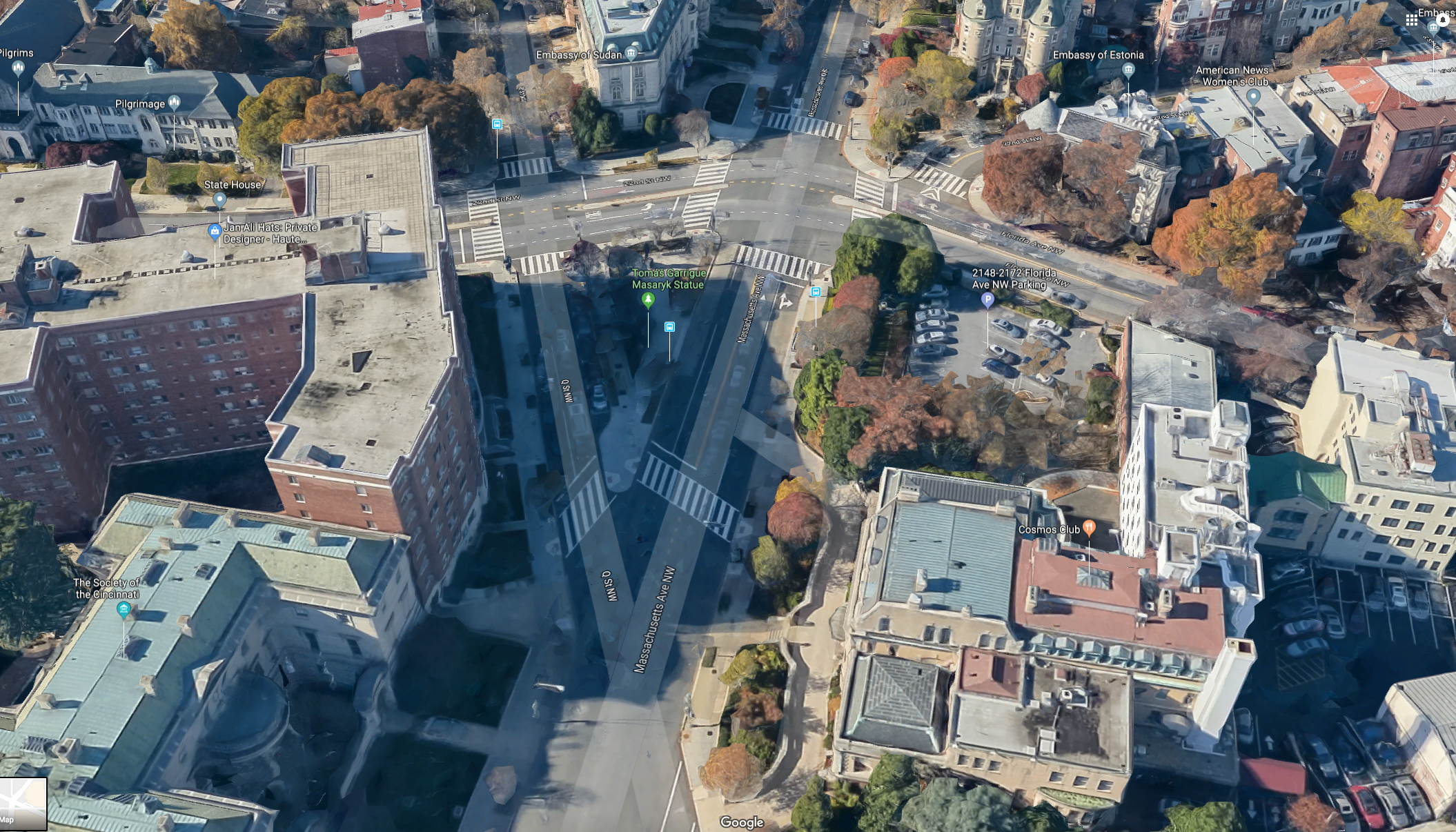
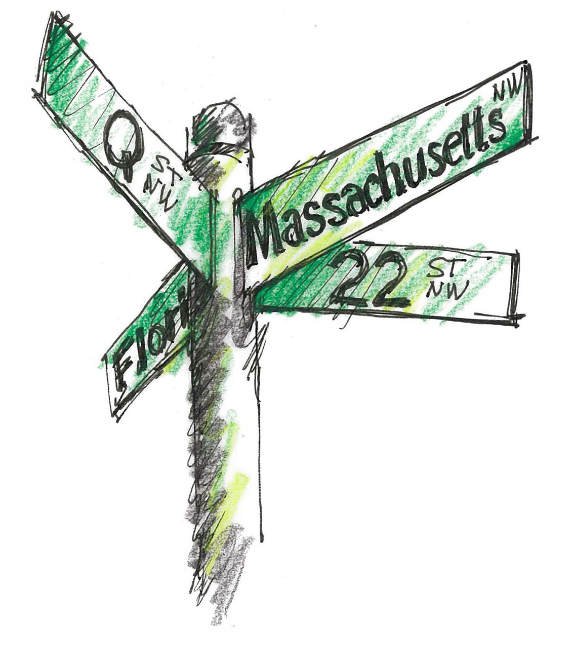 The downside of this city design mishmash: a city sliced into pizza-shaped blocks and dozens of dicey five and six-point intersections, some with monumental circles, some without. The non-circle six-pointers feature a numbered street and a letter-named street colliding with a state-named boulevard, “I’m at 21st and E and Virginia.” Or, “8th, Q and New Hampshire.” There are even areas with two intersecting state streets and a numbered and a lettered street all coming together within a small block. Try figuring out this wacky cross-block intersection: Florida, Connecticut, 21st and S Streets.
As urban walkers we are predisposed to perceiving a city in orthogonal form—left turns, right turns and all at right angles. We often add to this some sense of the compass and think in cardinal directions: North, South, East and West. So diagonals throw us off, especially those at unusual angles.
DC’s state streets can inadvertently lend a sense of north-south or east-west when you are actually moving at an angle, maybe SE or NW. Every time I walk down New Hampshire in the North West part of town my brain tries to make it north/south when I am really going southwesterly. Also, L’Enfant’s angled streets are not parallel to each other but may seem that way. And turning off an angled state street, on to a number or letter street requires careful reorientation – did I turn south or east? North or west? Maintaining orientation is easy while wayfinding with a series of left and right turns. Throw in a random angled street and you lose sense of the grid and all orientation. Time to bust out the map. Again.
Note that a plan featuring major streets at perfect 45-degree angles to a rectangular grid can actually work quite well, witness the rational four quadrants of Indianapolis organized around an X of major avenues. Or consider famous Columbus Avenue angling through San Francisco’s North Beach.
But in DC not so much. If you want to walk from the Phillips Collection to McPherson Square take 21st to K Street to 15th, avoiding the geographic/cartographic confusion of Massachusetts, New Hampshire and Connecticut. And don’t even think about navigating DC in a rental car.